
Space Archaeology in India: Discovering Ancient Secrets from the Sky
Unearthing lost civilizations without digging a single hole
Imagine discovering a lost city—without even setting foot on it. No digging, no dirt, no loud excavation equipment. Just a quiet satellite floating hundreds of kilometers above Earth, capturing an image. That image holds a secret. A shape. A shadow. A pattern. And with it, an ancient civilization comes back to life.
This is not a movie. It's not science fiction. This is space archaeology—one of the most exciting developments in the world of heritage and science. It's changing the way we understand our past. And it's slowly revealing that there's far more hidden under our feet than we ever imagined—especially here in India.
A New Way to Explore the Past
Traditional archaeology often starts with clues on the surface—ruins, old texts, oral histories. Then comes the digging. The tools. The layers of soil. The painstaking process of unearthing.
But space archaeology turns that on its head.
Thanks to satellites, drones, infrared sensors, and laser scanning, we can now peer into the earth, jungle, or ocean—without touching a single stone. Instead of digging first, we detect first.
And what we're finding is nothing short of mind-blowing.
Temples buried under forests. Roads under cities. Ancient water systems in deserts. Entire cities erased from memory—until they were spotted in a satellite image.
This isn't just about cool tech. It's about protecting our heritage before it disappears. It's about making archaeology faster, safer, and more accessible. And for India, a land overflowing with untapped history, it's a revolution waiting to happen.
What Exactly Is Space Archaeology?
At its core, space archaeology is using images from space to find archaeological remains on Earth.
It involves analyzing high-resolution satellite images, thermal scans, radar data, and 3D laser maps. These images are carefully studied by experts to spot unusual shapes, shadows, or temperature changes that might hint at buried structures—like walls, buildings, or ancient roads.
For example, a buried stone wall might make the grass above it grow differently. Or it might change how the ground absorbs heat. These tiny details are invisible to the human eye—but visible from space, especially with the right sensors.
Instead of sending large teams to dig blindly, archaeologists can now scan hundreds of kilometers in a single day, narrow down the most promising locations, and plan smarter excavations.
In a country like India, where many ancient sites lie beneath modern cities, forests, or farmland, this method could be the key to unlocking forgotten chapters of history.
Tools That Make It All Possible
So how does this magic happen? Let's look at the technologies that power this new-age archaeology:

LiDAR
Light That Reveals the Invisible
LiDAR stands for Light Detection and Ranging. It's like a super-powerful laser scanner, often mounted on drones, helicopters, or aircraft. It sends out thousands of laser pulses per second and measures how long they take to bounce back from the ground.
With this data, scientists can create a 3D map of the landscape—including what lies underneath trees or vegetation.
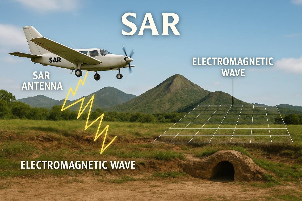
SAR
Seeing Through Clouds and Darkness
Synthetic Aperture Radar (SAR) is a radar imaging system that works in all weather conditions—rain, fog, clouds, and even at night. It sends microwaves that can penetrate through surfaces and reflect back from underground features.
SAR has been used in deserts, war zones, and floodplains to detect ancient canals, buried roads, and lost cities.
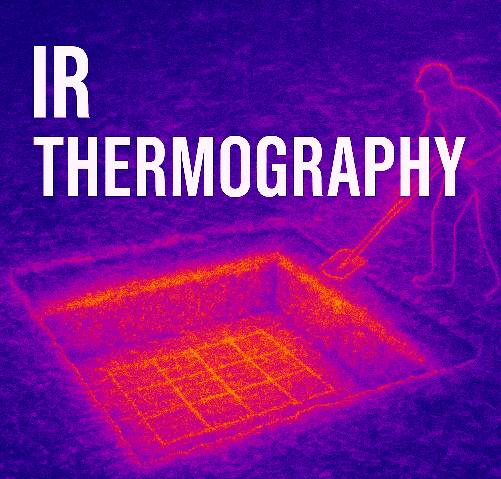
Infrared Thermography
Heat That Tells a Story
Infrared sensors measure how the ground heats and cools. Buried materials like bricks or stones affect this heat pattern. Using thermal imaging, we can spot these temperature anomalies and guess what might lie beneath.
This method is non-invasive and ideal for scanning large areas like fields or city outskirts.
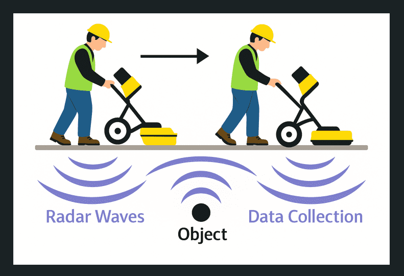
GPR
Radio Waves Into the Earth
Ground Penetrating Radar (GPR) sends radio waves into the earth and listens for reflections. It's great for detecting things like graves, foundations, tunnels, or hidden chambers.
Although GPR is used from the ground (and not space), it often works in combination with drone surveys and satellite data to confirm discoveries.
India's Parliament Gives It a Push
In 2023, the Indian government made a significant move.
A special Parliamentary Standing Committee on Transport, Tourism and Culture released a report urging the Archaeological Survey of India (ASI) to collaborate with space agencies like ISRO.
The report clearly stated:
"The Ministry should utilize advanced technologies such as satellite imaging, drones, and LiDAR in collaboration with ISRO to detect, preserve, and digitally map India's undiscovered heritage."
This shows a strong national commitment toward adopting high-tech methods to protect what's left of our ancient glory.
It also opens the door for public-private partnerships, NGO involvement, and academic collaborations that could fast-track space archaeology across India.
What the World Has Already Achieved
India is just starting out, but other countries have already made incredible progress with space archaeology.
Egypt
Dr. Sarah Parcak became world-famous when she used NASA satellite imagery to discover 17 lost pyramids, 1,000 tombs, and 3,000 ancient settlements under the sand. All without a single dig.
Guatemala
A LiDAR survey uncovered more than 60,000 Mayan ruins hidden under thick jungle. It completely changed historians' understanding of how advanced Mayan cities were.
Cambodia
Near Angkor Wat, researchers mapped out entire cities that had vanished under forests—revealing a much bigger Khmer Empire than previously known.
So, if they can do it, why can't we?
India: A Land of Buried Secrets
India's heritage isn't just rich—it's buried deep. Literally.
We are home to civilizations that go back thousands of years. From Indus Valley cities like Dholavira and Lothal to the Vedic-era heartlands of Kurukshetra and Mathura, our land is layered with history.
Unfortunately, many of these places are either unknown or lie beneath modern settlements.
Here's how space archaeology can help:
- Kurukshetra: Map out ancient battlegrounds, discover lost forts, or identify areas that match descriptions from the Mahabharata.
- Mathura & Braj Bhoomi: Find ponds, temples, and shrines described in Puranas, now hidden or forgotten.
- Dwaraka: Use radar and underwater imaging to explore the possible remains of Krishna's legendary city.
- Eastern India: Odisha, Jharkhand, and Andhra Pradesh may still hold Buddhist ruins under dense jungles or hills.
- Urban India: Cities like Varanasi, Ujjain, or Patna are built layer over layer. Imagine what lies beneath?
With ISRO's powerful satellite tech and expert teams on the ground, we can map, protect, and digitally restore thousands of lost sites.
Why Now? What's the Rush?
Because we're losing sites every year.
Construction, illegal mining, looting, floods, and plain ignorance wipe out history that we didn't even know existed. Once it's gone, it's gone forever.
That's why space archaeology is not just exciting—it's urgent.
Here's what it offers:
Preservation without damage
No digging means no harm to fragile remains.
Speed
Cover thousands of square kilometers in days, not years.
Preventive action
Discover sites before a highway or factory destroys them.
Education & Tourism
Turn discoveries into digital experiences—museums, VR walkthroughs, or school modules.
The Road Ahead: India's Space Archaeology Movement
India stands at the edge of a new archaeological era.
Organizations like Historika Foundations are leading the charge. They're combining technology with tradition—using LiDAR, GPR, SAR, and AI to map and preserve sites in Mathura, Braj, Kurukshetra, and beyond.
The dream?
Imagine exploring a lost city in 3D. Walking down reconstructed streets of ancient Nalanda. Experiencing the Yamuna as described in the Rigveda. Not in a textbook—but in immersive VR or on your phone.
That's the power of space archaeology.
And with support from the government, scientists, and citizens like you, India can become a global leader in this field.
Support Space ArchaeologyFinal Thoughts: The Sky Is Our New Shovel
History used to be dug up.
Now, it's scanned, mapped, and brought back to life from the skies.
Space archaeology isn't just about technology. It's about telling forgotten stories. About reconnecting with the wisdom, art, and spirit of our ancestors. It's about making sure their voices don't disappear in silence.
As India races toward the future, it's time we also looked back.
Not just with a shovel, but with a satellite.
Because our past is waiting to be found.
All we have to do... is look up.